
Unorganized North Algoma trails
Click on a trail to view its statistics, map and profile.
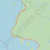
Lake Superior Provincial Park - Harmony Beach
Canada > Ontario > Algoma District > Unorganized North Algoma
Distance: 58.5 mi • Elevation gain: 3,009 ft • Maximum elevation: 1,270 ft
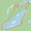
Walking around Parks Lake at Josephine Mine
Canada > Ontario > Algoma District > Unorganized North Algoma
Distance: 3.5 mi • Elevation gain: 364 ft • Maximum elevation: 1,309 ft

ATV riding at Anjigami
Canada > Ontario > Algoma District > Unorganized North Algoma
ATV, trail
Distance: 3.0 mi • Elevation gain: 233 ft • Maximum elevation: 991 ft
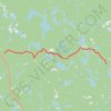
Riding to Magpie Mine
Canada > Ontario > Algoma District > Unorganized North Algoma
Distance: 8.6 mi • Elevation gain: 407 ft • Maximum elevation: 1,447 ft