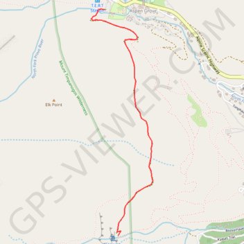
Stewart Falls
Interactive trail map
Trail profile
- Distance: 3.4 mi
- Elevation gain: 820 ft
- Maximum elevation: 7,198 ft
- Elevation loss: 820 ft
- Minimum elevation: 6,854 ft
About this trail
Name: Stewart Falls trail, distance, elevation, map, profile, GPS track
Start: Stewarts Cascade Trail, Aspen Grove, Utah County, Utah, United States (40.40421 -111.60550)
End: Stewarts Cascade Trail, Aspen Grove, Utah County, Utah, United States (40.40421 -111.60550)
Coordinates: 40.38641 -111.60685 40.40423 -111.60051
Topography: Utah County topographic map, elevation, terrain