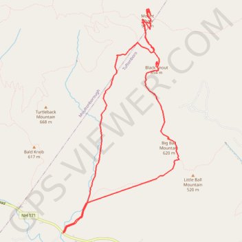
Black Snout and Mount Shaw Loop
Hike to Mount Shaw via Mount Shaw Trail, Italian Trail, Big Ball Mountain, Black Snout Trail and High Ridge Trail. #Hiking #Loop #Mountain #Nature #Forest
- Distance: 7.6 mi
- Elevation gain: 2,425 ft
- Maximum elevation: 2,936 ft
- Elevation loss: 2,425 ft
- Minimum elevation: 682 ft
- Moving time: 5 h 58 m
- Moving speed: 1.3 mph
- Maximum speed: 2.6 mph
- Total time: 8 h 1 m
- Global speed: 0.9 mph
Interactive trail map
Trail profile
- Distance: 7.6 mi
- Elevation gain: 2,425 ft
- Maximum elevation: 2,936 ft
- Elevation loss: 2,425 ft
- Minimum elevation: 682 ft
- Moving time: 5 h 58 m
- Moving speed: 1.3 mph
- Maximum speed: 2.6 mph
- Total time: 8 h 1 m
- Global speed: 0.9 mph
About this trail
Name: Black Snout and Mount Shaw Loop trail, distance, elevation, map, profile, GPS track
Coordinates: 43.71075 -71.29192 43.74415 -71.26797
Topography: Carroll County topographic map, elevation, terrain
Other hiking, mountain biking, running and outdoor activity trails
Click on a trail to view its statistics, map and profile.