Make a donation
Gear up for your next adventure:
As an Amazon Associate, this site earns from qualifying purchases at no extra cost to you.
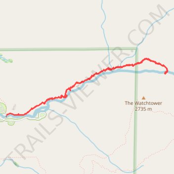
Sequoia Tokopah Falls
- Distance: 3.9 mi
- Elevation gain: 620 ft
- Maximum elevation: 7,405 ft
- Elevation loss: 764 ft
- Minimum elevation: 6,801 ft
- Moving time: 1 h 48 m
- Moving speed: 2.1 mph
- Maximum speed: 6.7 mph
- Total time: 2 h 14 m
- Global speed: 1.7 mph
Interactive trail map
Make a donation
Gear up for your next adventure:
As an Amazon Associate, this site earns from qualifying purchases at no extra cost to you.
Trail profile
- Distance: 3.9 mi
- Elevation gain: 620 ft
- Maximum elevation: 7,405 ft
- Elevation loss: 764 ft
- Minimum elevation: 6,801 ft
- Moving time: 1 h 48 m
- Moving speed: 2.1 mph
- Maximum speed: 6.7 mph
- Total time: 2 h 14 m
- Global speed: 1.7 mph
Make a donation
Gear up for your next adventure:
As an Amazon Associate, this site earns from qualifying purchases at no extra cost to you.
About this trail
Name: Sequoia Tokopah Falls trail, distance, elevation, map, profile, GPS track
Start: Tokopah Falls Trail, Tulare County, California, United States (36.60705 -118.71562)
End: Tokopah Falls Trail, Tulare County, California, United States (36.60511 -118.72273)
Coordinates: 36.60511 -118.72273 36.61304 -118.69452
Topography: Tulare County topographic map, elevation, terrain
Make a donation
Gear up for your next adventure:
As an Amazon Associate, this site earns from qualifying purchases at no extra cost to you.
Other hiking, mountain biking, running and outdoor activity trails
Click on a trail to view its statistics, map and profile.
Tokopah Falls Trail in Sequoia National Park
United States > California > Tulare County
The Tokopah Falls Trail in Sequoia National Park offers a delightful hiking experience, weaving through majestic forests and alongside the Marble Fork Kaweah River. Hikers can enjoy the serene beauty of the river, the towering granite cliffs, and the impressive Watchtower peak. The trail culminates at the base…
Distance: 4.1 mi • Elevation gain: 623 ft • Maximum elevation: 7,359 ft