Agnew Meadows to Ediza Lake via Shadow Creek Trail, Olaine Lake and Shadow Lake
The hike to Ediza Lake via the Shadow Creek Trail offers a remarkable journey through the scenic heart of the Ansel Adams Wilderness. As you pass Shadow Lake, you'll witness serene waters framed by towering peaks, while the trail winds through lush forests, cascading streams, and wildflower-filled meadows. Reaching Ediza Lake, with its stunning reflection of Mount Ritter and Banner Peak, provides a tranquil escape, making this trail a memorable route for nature lovers and backpackers alike. #Hiking #Mountain #Lake #Forest #Nature
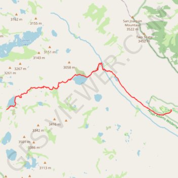
- Distance: 6.8 mi
- Elevation gain: 1,519 ft
- Maximum elevation: 9,314 ft
- Elevation loss: 518 ft
- Minimum elevation: 8,054 ft
Interactive trail map
Trail profile
- Distance: 6.8 mi
- Elevation gain: 1,519 ft
- Maximum elevation: 9,314 ft
- Elevation loss: 518 ft
- Minimum elevation: 8,054 ft
About this trail
Name: Agnew Meadows to Ediza Lake via Shadow Creek Trail, Olaine Lake and Shadow Lake trail, distance, elevation, map, profile, GPS track
Start: Agnew Meadows Road, Madera County, California, United States (37.68199 -119.08612)
End: Ediza Lake Spur Trail, Madera County, California, United States (37.68208 -119.16906)
Coordinates: 37.67981 -119.16906 37.70067 -119.08601
Topography: Madera County topographic map, elevation, terrain
Other hiking, mountain biking, running and outdoor activity trails
Click on a trail to view its statistics, map and profile.
Mammoth to Bridgeport
United States > California > Mono County > Mammoth Lakes
Northern California Backcountry Discovery Route (CABDR-North)
Distance: 94.8 mi • Elevation gain: 7,188 ft • Maximum elevation: 9,259 ft