Los Altos Hills trails
Afternoon Run
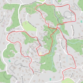
- Distance: 3.5 mi
- Elevation gain: 791 ft
- Maximum elevation: 738 ft
- Elevation loss: 840 ft
- Minimum elevation: 318 ft
- Moving time: 1 h 2 m
- Moving speed: 3.3 mph
- Maximum speed: 6.7 mph
- Total time: 1 h 2 m
- Global speed: 3.3 mph
Interactive trail map
Trail profile
- Distance: 3.5 mi
- Elevation gain: 791 ft
- Maximum elevation: 738 ft
- Elevation loss: 840 ft
- Minimum elevation: 318 ft
- Moving time: 1 h 2 m
- Moving speed: 3.3 mph
- Maximum speed: 6.7 mph
- Total time: 1 h 2 m
- Global speed: 3.3 mph
About this trail
Name: Los Altos Hills trails trail, distance, elevation, map, profile, GPS track
Coordinates: 37.36596 -122.16879 37.37667 -122.15663
Topography: Santa Clara County topographic map, elevation, terrain