Thank you for supporting this site ❤️
Make a donation
Make a donation
Gear up for your next adventure:
As an Amazon Associate, this site earns from qualifying purchases at no extra cost to you.
RE SE910050
- Distance: 1.8 mi
- Elevation gain: 33 ft
- Maximum elevation: 72 ft
- Elevation loss: 30 ft
- Minimum elevation: 59 ft
Interactive trail map
Thank you for supporting this site ❤️
Make a donation
Make a donation
Gear up for your next adventure:
As an Amazon Associate, this site earns from qualifying purchases at no extra cost to you.
Trail profile
- Distance: 1.8 mi
- Elevation gain: 33 ft
- Maximum elevation: 72 ft
- Elevation loss: 30 ft
- Minimum elevation: 59 ft
Thank you for supporting this site ❤️
Make a donation
Make a donation
Gear up for your next adventure:
As an Amazon Associate, this site earns from qualifying purchases at no extra cost to you.
About this trail
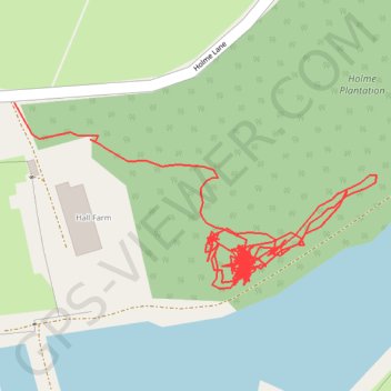
Name: RE SE910050 trail, distance, elevation, map, profile, GPS track
Coordinates: 53.53415 -0.63170 53.53595 -0.62581
Thank you for supporting this site ❤️
Make a donation
Make a donation
Gear up for your next adventure:
As an Amazon Associate, this site earns from qualifying purchases at no extra cost to you.
Other hiking, mountain biking, running and outdoor activity trails
Click on a trail to view its statistics, map and profile.
Gravel ride loop from Sheffield to Hornsea and York
United Kingdom > England > Sheffield
Distance: 207.1 mi • Elevation gain: 6,024 ft • Maximum elevation: 728 ft