Make a donation
Gear up for your next adventure:
As an Amazon Associate, this site earns from qualifying purchases at no extra cost to you.
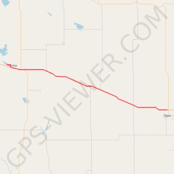
Hanna - Oyen
Interactive trail map
Make a donation
Gear up for your next adventure:
As an Amazon Associate, this site earns from qualifying purchases at no extra cost to you.
Trail profile
- Distance: 70.1 mi
- Elevation gain: 728 ft
- Maximum elevation: 2,707 ft
- Elevation loss: 879 ft
- Minimum elevation: 2,500 ft
Make a donation
Gear up for your next adventure:
As an Amazon Associate, this site earns from qualifying purchases at no extra cost to you.
About this trail
Name: Hanna - Oyen trail, distance, elevation, map, profile, GPS track
Start: Township Road 312, Special Area No. 2, Alberta, Canada (51.65202 -111.97972)
End: Highway 9, Special Area No. 3, Alberta, T0J 2J0, Canada (51.38707 -110.48271)
Coordinates: 51.38706 -111.97972 51.65202 -110.48271
Make a donation
Gear up for your next adventure:
As an Amazon Associate, this site earns from qualifying purchases at no extra cost to you.
Other hiking, mountain biking, running and outdoor activity trails
Click on a trail to view its statistics, map and profile.
Drumheller - Hanna
Canada > Alberta > Drumheller > Drumheller
#Bike #Drumheller #Hanna
Distance: 48.9 mi • Elevation gain: 1,440 ft • Maximum elevation: 2,999 ft
Oyen - Kindersley
Canada > Alberta > Special Area No. 3
#Bike #Oyen #Kindersley
Distance: 60.8 mi • Elevation gain: 1,030 ft • Maximum elevation: 2,536 ft