Make a donation
Gear up for your next adventure:
As an Amazon Associate, this site earns from qualifying purchases at no extra cost to you.
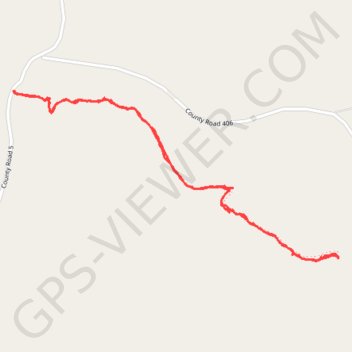
Whitaker Point
Interactive trail map
Make a donation
Gear up for your next adventure:
As an Amazon Associate, this site earns from qualifying purchases at no extra cost to you.
Trail profile
- Distance: 2.9 mi
- Elevation gain: 522 ft
- Maximum elevation: 2,195 ft
- Elevation loss: 522 ft
- Minimum elevation: 1,854 ft
Make a donation
Gear up for your next adventure:
As an Amazon Associate, this site earns from qualifying purchases at no extra cost to you.
About this trail
Name: Whitaker Point trail, distance, elevation, map, profile, GPS track
Start: Whitaker Point Trail, Newton County, Arkansas, United States (35.89827 -93.45801)
End: Whitaker Point Trail, Newton County, Arkansas, United States (35.89827 -93.45801)
Coordinates: 35.89083 -93.45801 35.89827 -93.44043
Topography: Newton County topographic map, elevation, terrain
Make a donation
Gear up for your next adventure:
As an Amazon Associate, this site earns from qualifying purchases at no extra cost to you.
Other hiking, mountain biking, running and outdoor activity trails
Click on a trail to view its statistics, map and profile.
Whitaker Point Trail to Hawksbill Crag in Ozark-St. Francis National Forest
United States > Arkansas > Newton County > Ryker
The Whitaker Point Trail offers a captivating journey through the lush landscapes of the Ozark-St. Francis National Forest, leading to the iconic Hawksbill Crag. Hikers will experience a variety of natural features, including dense forests, rocky outcrops, and stunning panoramic views of the surrounding…
Distance: 2.7 mi • Elevation gain: 456 ft • Maximum elevation: 2,195 ft