Storm King Mountain Loop via Butter Hill Trail, Stillman Trail and Bypass Trail
The Storm King Mountain Loop offers hikers a rewarding experience with its diverse terrain and panoramic vistas. The journey begins with a steep ascent up Butter Hill, leading to expansive views of the Hudson River and the surrounding mountains. As you continue along the Stillman Trail, the path meanders through varied landscapes, including rocky outcrops and forested sections, culminating in breathtaking vistas near the Storm King summit. This loop is ideal for those seeking a moderate challenge combined with some of the most stunning views in the Hudson Valley. #Hiking #Mountain #Forest #Nature #Loop #Overlook #River
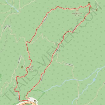
- Distance: 2.3 mi
- Elevation gain: 548 ft
- Maximum elevation: 1,325 ft
- Elevation loss: 554 ft
- Minimum elevation: 922 ft
- Moving time: 1 h 27 m
- Moving speed: 1.6 mph
- Maximum speed: 3.1 mph
- Total time: 1 h 43 m
- Global speed: 1.4 mph
Interactive trail map
Trail profile
- Distance: 2.3 mi
- Elevation gain: 548 ft
- Maximum elevation: 1,325 ft
- Elevation loss: 554 ft
- Minimum elevation: 922 ft
- Moving time: 1 h 27 m
- Moving speed: 1.6 mph
- Maximum speed: 3.1 mph
- Total time: 1 h 43 m
- Global speed: 1.4 mph
About this trail
Name: Storm King Mountain Loop via Butter Hill Trail, Stillman Trail and Bypass Trail trail, distance, elevation, map, profile, GPS track
Coordinates: 41.42310 -74.00354 41.43353 -73.99268
Topography: Orange County topographic map, elevation, terrain
Other hiking, mountain biking, running and outdoor activity trails
Click on a trail to view its statistics, map and profile.
Storm King Mountain via Butter Hill Trail, Stillman Trail and Bypass Trail in Storm King State Park
United States > New York > Orange County > Town of Cornwall > Village of Cornwall-on-Hudson
The Storm King Mountain Loop is a rewarding, moderately challenging hike that brings scenic views and diverse terrain, making it popular among both locals and visitors to New York's Hudson Valley. The trail offers impressive vistas over the Hudson River, with sweeping views of the Catskill Mountains to the…
Distance: 2.4 mi • Elevation gain: 558 ft • Maximum elevation: 1,329 ft