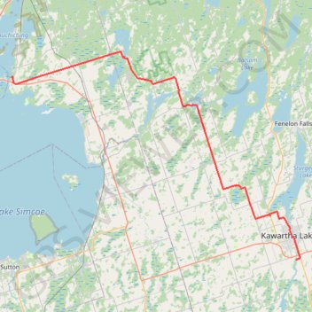
Import a GPX file

Orillia - Lindsay

#Bike #Orillia #Lindsay

  • Distance: 51.7 mi
  • Elevation gain: 1,230 ft
  • Maximum elevation: 988 ft
  • Elevation loss: 1,132 ft
  • Minimum elevation: 725 ft

Interactive trail map

Trail profile

  • Distance: 51.7 mi
  • Elevation gain: 1,230 ft
  • Maximum elevation: 988 ft
  • Elevation loss: 1,132 ft
  • Minimum elevation: 725 ft

About this trail

Other hiking, mountain biking, running and outdoor activity trails

Click on a trail to view its statistics, map and profile.

Québec - Montréal - Saint-Laurent River - Lake Ontario - Niagara Falls

Canada > Quebec > Urban agglomeration of Québec > Quebec

#Bike #Ontario

Distance: 670.1 mi • Elevation gain: 15,761 ft • Maximum elevation: 686 ft

Wasaga Beach - Orillia

Canada > Ontario > Simcoe County > Wasaga Beach

#Bike #WasagaBeach #Orillia

Distance: 50.5 mi • Elevation gain: 1,476 ft • Maximum elevation: 1,125 ft

Gear up for your next adventure:

🔋Rechargeable Batteries - Power up your outdoor devices
📡GPS Antenna Upgrade - Enhance GPS reception in remote terrain
🛶Inflatable Kayak - Portable kayak for rivers, lakes, and expeditions
🚗GPS Dash Cams - Record your scenic drives through mountain passes and canyons
🦶Hiking Gaiters - Keep debris and water out of your boots

As an Amazon Associate, this site earns from qualifying purchases at no extra cost to you.