
Copperas Falls Trail in Clifty Wilderness
The Copperas Falls Trail offers a serene creekside journey through the Clifty Wilderness, where hikers can enjoy the sound of flowing water and dense forests. Along the way, you'll pass lush rhododendron groves, rock outcrops, and scenic views leading to the 40-foot Copperas Falls, which cascades dramatically over a cave. While the trail is not officially maintained, its well-trodden path makes it relatively easy to follow, though the occasional creek crossing and uneven terrain can challenge hikers. #Hiking #Waterfall #River #Forest #Nature
- Distance: 3.3 mi
- Elevation gain: 285 ft
- Maximum elevation: 1,004 ft
- Elevation loss: 285 ft
- Minimum elevation: 771 ft
- Moving time: 1 h 13 m
- Moving speed: 2.7 mph
- Maximum speed: 8.7 mph
- Total time: 1 h 29 m
- Global speed: 2.2 mph
Interactive trail map
Trail profile
- Distance: 3.3 mi
- Elevation gain: 285 ft
- Maximum elevation: 1,004 ft
- Elevation loss: 285 ft
- Minimum elevation: 771 ft
- Moving time: 1 h 13 m
- Moving speed: 2.7 mph
- Maximum speed: 8.7 mph
- Total time: 1 h 29 m
- Global speed: 2.2 mph
About this trail
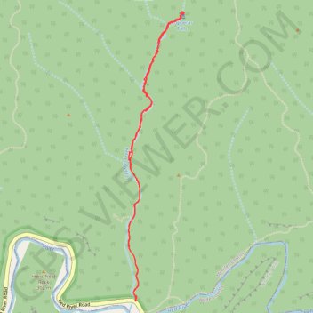
Name: Copperas Falls Trail in Clifty Wilderness trail, distance, elevation, map, profile, GPS track
Start: Red River Road, Menifee County, Kentucky, United States (37.82100 -83.57564)
End: Red River Road, Menifee County, Kentucky, United States (37.82103 -83.57564)
Coordinates: 37.82100 -83.57622 37.84136 -83.57127
Topography: Menifee County topographic map, elevation, terrain