Make a donation
Gear up for your next adventure:
As an Amazon Associate, this site earns from qualifying purchases at no extra cost to you.
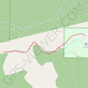
Seven Bridges Trail
Interactive trail map
Make a donation
Gear up for your next adventure:
As an Amazon Associate, this site earns from qualifying purchases at no extra cost to you.
Trail profile
- Distance: 3.5 mi
- Elevation gain: 942 ft
- Maximum elevation: 8,448 ft
- Elevation loss: 942 ft
- Minimum elevation: 7,520 ft
Make a donation
Gear up for your next adventure:
As an Amazon Associate, this site earns from qualifying purchases at no extra cost to you.
About this trail
Name: Seven Bridges Trail trail, distance, elevation, map, profile, GPS track
Start: North Cheyenne Canyon Road, El Paso County, Colorado, United States (38.79068 -104.90399)
End: North Cheyenne Canyon Road, El Paso County, Colorado, United States (38.79068 -104.90399)
Coordinates: 38.78623 -104.92954 38.79121 -104.90399
Topography: El Paso County topographic map, elevation, terrain
Make a donation
Gear up for your next adventure:
As an Amazon Associate, this site earns from qualifying purchases at no extra cost to you.
Other hiking, mountain biking, running and outdoor activity trails
Click on a trail to view its statistics, map and profile.
St. Mary's Falls Trail in Pike National Forest
United States > Colorado > El Paso County
The St. Mary’s Falls Trail in Pike National Forest offers a rewarding hike through North Cheyenne Canyon. Beginning on a closed section of Gold Camp Road, the route passes through a mix of aspen and pine forests, offering views of small waterfalls and a flowing creek along the way. The final stretch involves…
Distance: 6.5 mi • Elevation gain: 1,512 ft • Maximum elevation: 8,924 ft
Kineo Mountain Trail, Upper Bear Creek and Seven Bridges loop hike
United States > Colorado > El Paso County
Distance: 7.2 mi • Elevation gain: 1,867 ft • Maximum elevation: 9,085 ft