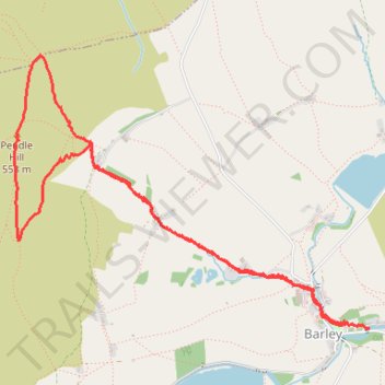
Up and down Pendle Hill
- Distance: 4.3 mi
- Elevation gain: 1,112 ft
- Maximum elevation: 1,831 ft
- Elevation loss: 1,129 ft
- Minimum elevation: 722 ft
- Moving time: 2 h 17 m
- Moving speed: 1.9 mph
- Maximum speed: 4.9 mph
- Total time: 2 h 37 m
- Global speed: 1.6 mph
Interactive trail map
Trail profile
- Distance: 4.3 mi
- Elevation gain: 1,112 ft
- Maximum elevation: 1,831 ft
- Elevation loss: 1,129 ft
- Minimum elevation: 722 ft
- Moving time: 2 h 17 m
- Moving speed: 1.9 mph
- Maximum speed: 4.9 mph
- Total time: 2 h 37 m
- Global speed: 1.6 mph
About this trail
Name: Up and down Pendle Hill trail, distance, elevation, map, profile, GPS track
Coordinates: 53.85872 -2.29875 53.87253 -2.26831
Other hiking, mountain biking, running and outdoor activity trails
Click on a trail to view its statistics, map and profile.