Skyline Trail - Maligne Lake
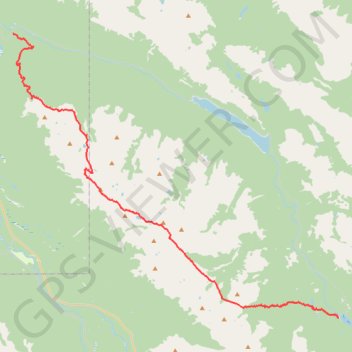
Interactive trail map
Trail profile
- Distance: 28.8 mi
- Elevation gain: 4,869 ft
- Maximum elevation: 8,294 ft
- Elevation loss: 6,617 ft
- Minimum elevation: 3,812 ft
About this trail
Name: Skyline Trail - Maligne Lake trail, distance, elevation, map, profile, GPS track
Start: Maligne Lake road, Improvement District No. 12, Alberta, Canada (52.72618 -117.64545)
End: Trail 7 Andretti's, Municipality of Jasper, Alberta, Canada (52.91431 -118.00147)
Coordinates: 52.72618 -118.00151 52.91431 -117.64545
Other hiking, mountain biking, running and outdoor activity trails
Click on a trail to view its statistics, map and profile.
Jasper National Park - Skyline Trail
Canada > Alberta > Improvement District No. 12
Distance: 30.1 mi • Elevation gain: 5,981 ft • Maximum elevation: 8,343 ft