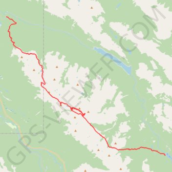
Jasper National Park - Skyline Trail
- Distance: 30.1 mi
- Elevation gain: 5,981 ft
- Maximum elevation: 8,343 ft
- Elevation loss: 7,697 ft
- Minimum elevation: 3,816 ft
Interactive trail map
Trail profile
- Distance: 30.1 mi
- Elevation gain: 5,981 ft
- Maximum elevation: 8,343 ft
- Elevation loss: 7,697 ft
- Minimum elevation: 3,816 ft
About this trail
Name: Jasper National Park - Skyline Trail trail, distance, elevation, map, profile, GPS track
End: Trail 7 Andretti's, Municipality of Jasper, Alberta, Canada (52.91403 -118.00132)
Coordinates: 52.72610 -118.00132 52.91403 -117.64400
Other hiking, mountain biking, running and outdoor activity trails
Click on a trail to view its statistics, map and profile.