Bear Peak
Hike from National Center for Atmospheric Research to Bear Peak via Table Mountain, N.C.A.R. Trail, Mesa Trail and Fern Canyon Trail in Boulder Open Space and Mountain Parks.
#Hiking #Mountain #Forest #Summit #Nature
- Distance: 2.9 mi
- Elevation gain: 2,438 ft
- Maximum elevation: 8,343 ft
- Elevation loss: 207 ft
- Minimum elevation: 6,086 ft
- Moving time: 1 h 38 m
- Moving speed: 1.8 mph
- Maximum speed: 6.2 mph
- Total time: 2 h 13 m
- Global speed: 1.3 mph
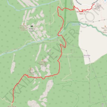
Interactive trail map
Trail profile
- Distance: 2.9 mi
- Elevation gain: 2,438 ft
- Maximum elevation: 8,343 ft
- Elevation loss: 207 ft
- Minimum elevation: 6,086 ft
- Moving time: 1 h 38 m
- Moving speed: 1.8 mph
- Maximum speed: 6.2 mph
- Total time: 2 h 13 m
- Global speed: 1.3 mph
About this trail
Name: Bear Peak trail, distance, elevation, map, profile, GPS track
Start: N.C.A.R. Trail, Boulder, Boulder County, Colorado, 80305, United States (39.97850 -105.27564)
End: Fern Canyon Trail, Boulder County, Colorado, 80025, United States (39.96054 -105.29502)
Coordinates: 39.96054 -105.29506 39.97850 -105.27564
Topography: Boulder topographic map, elevation, terrain
Other hiking, mountain biking, running and outdoor activity trails
Click on a trail to view its statistics, map and profile.
Bear Peak via Shanahan Trail and Fern Canyon Trail
United States > Colorado > Boulder County > Boulder
The Bear Peak hike via Shanahan and Fern Canyon Trails in City of Boulder Open Space and Mountain Parks offers a challenging ascent with rewarding panoramic views. Along the way, hikers encounter a steep climb through varied terrain, including rocky paths and dense forests. Upon reaching the summit, the vistas…
Distance: 4.9 mi • Elevation gain: 2,589 ft • Maximum elevation: 8,350 ft
Mallory Cave Trail via NCAR Trail and Table Mountain
United States > Colorado > Boulder County > Boulder
The Mallory Cave Trail via the NCAR and Table Mountain offers a rewarding hike through Boulder’s iconic foothills. Starting from the NCAR campus, the trail winds through open meadows, offering striking views of the Flatirons and red rock formations. The final section involves a challenging scramble up to the…
Distance: 2.8 mi • Elevation gain: 932 ft • Maximum elevation: 6,824 ft