Phantom Falls Trail in North Table Mountain Ecological Preserve
The Phantom Falls Trail offers a rewarding hike through rolling hills, vibrant wildflower meadows, and unique basalt rock formations. As you journey across the open landscape, seasonal vernal pools and grazing cattle add to the rustic charm. The trail culminates at Phantom Falls, a dramatic cascade plunging into a hidden canyon, providing a striking contrast to the surrounding grasslands. Visitors should be aware that the falls may be dry in the summer months. #Hiking #Waterfall #Canyon #Rock #Nature
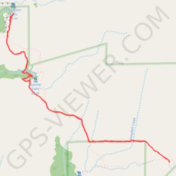
- Distance: 3.8 mi
- Elevation gain: 489 ft
- Maximum elevation: 1,342 ft
- Elevation loss: 489 ft
- Minimum elevation: 1,132 ft
- Moving time: 1 h 35 m
- Moving speed: 2.4 mph
- Maximum speed: 3.5 mph
- Total time: 1 h 49 m
- Global speed: 2.1 mph
Interactive trail map
Trail profile
- Distance: 3.8 mi
- Elevation gain: 489 ft
- Maximum elevation: 1,342 ft
- Elevation loss: 489 ft
- Minimum elevation: 1,132 ft
- Moving time: 1 h 35 m
- Moving speed: 2.4 mph
- Maximum speed: 3.5 mph
- Total time: 1 h 49 m
- Global speed: 2.1 mph
About this trail
Name: Phantom Falls Trail in North Table Mountain Ecological Preserve trail, distance, elevation, map, profile, GPS track
Coordinates: 39.59588 -121.56153 39.60971 -121.54188
Topography: Butte County topographic map, elevation, terrain
Other hiking, mountain biking, running and outdoor activity trails
Click on a trail to view its statistics, map and profile.