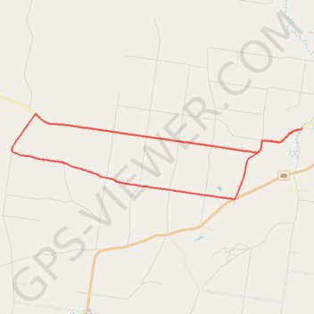
Taabinga-Mannuem
- Distance: 26.4 mi
- Elevation gain: 1,345 ft
- Maximum elevation: 1,791 ft
- Elevation loss: 1,345 ft
- Minimum elevation: 1,375 ft
- Moving time: 2 h 16 m
- Moving speed: 11.6 mph
- Maximum speed: 32.7 mph
- Total time: 2 h 52 m
- Global speed: 9.2 mph
Interactive trail map
Trail profile
- Distance: 26.4 mi
- Elevation gain: 1,345 ft
- Maximum elevation: 1,791 ft
- Elevation loss: 1,345 ft
- Minimum elevation: 1,375 ft
- Moving time: 2 h 16 m
- Moving speed: 11.6 mph
- Maximum speed: 32.7 mph
- Total time: 2 h 52 m
- Global speed: 9.2 mph
About this trail
Name: Taabinga-Mannuem trail, distance, elevation, map, profile, GPS track
Coordinates: -26.62633 151.60968 -26.57911 151.79029
Other hiking, mountain biking, running and outdoor activity trails
Click on a trail to view its statistics, map and profile.
Kingaroy Taabinga Boonenne trace
Australia > Queensland > Kingaroy
Loop bike around Kingaroy. #Bike #Loop #Countryside #Nature #Forest
Distance: 22.9 mi • Elevation gain: 1,207 ft • Maximum elevation: 1,778 ft
Ushers Hill and Archookoora State Forest loop
Distance: 32.7 mi • Elevation gain: 2,149 ft • Maximum elevation: 1,847 ft
Memerambi to Ushers Hill
Memerambi, Crawford, Kingaroy, Taabinga, Queensland
Distance: 29.3 mi • Elevation gain: 1,089 ft • Maximum elevation: 1,860 ft
Mannuem to Gordonbrook
Wattle Grove, Dangore, Gordonbrook, Queensland
Distance: 29.5 mi • Elevation gain: 1,529 ft • Maximum elevation: 1,755 ft
Taabinga and Wattle Grove
Australia > Queensland > Kingaroy
Kingaroy, Taabinga, Inverlaw, Wattle Grove
Distance: 33.7 mi • Elevation gain: 1,555 ft • Maximum elevation: 1,778 ft
Inverlaw to Kumbia
Inverlaw, Benair, Kumbia, Queensland
Distance: 25.3 mi • Elevation gain: 1,102 ft • Maximum elevation: 1,762 ft
Chahpingah to Kumbia
Ironpot Road
Distance: 29.8 mi • Elevation gain: 2,402 ft • Maximum elevation: 1,818 ft
Kumbia to Benair loop
Australia > Queensland > Kumbia
Distance: 18.9 mi • Elevation gain: 896 ft • Maximum elevation: 1,795 ft