Friday Harbour Nature Reserve
#Hiking #MTB #Snowshoeing #Loop #FridayHarbour
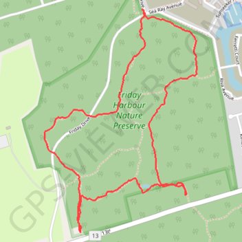
- Distance: 2.9 mi
- Elevation gain: 72 ft
- Maximum elevation: 791 ft
- Elevation loss: 72 ft
- Minimum elevation: 745 ft
Interactive trail map
Trail profile
- Distance: 2.9 mi
- Elevation gain: 72 ft
- Maximum elevation: 791 ft
- Elevation loss: 72 ft
- Minimum elevation: 745 ft
About this trail
Name: Friday Harbour Nature Reserve trail, distance, elevation, map, profile, GPS track
Coordinates: 44.38079 -79.54589 44.39269 -79.53453
Other hiking, mountain biking, running and outdoor activity trails
Click on a trail to view its statistics, map and profile.