Rainbow Falls Trail in Great Smoky Mountains National Park
The Rainbow Falls Trail offers a breathtaking experience with its lush, forested pathways leading to the stunning Rainbow Falls, known for its impressive 80-foot drop. Along the hike, visitors can enjoy views of LeConte Creek, several picturesque footbridges, and vibrant wildflowers in spring. This moderately challenging route rewards hikers not only with the beauty of the waterfall but also with the option to continue on to the summit of Mount LeConte, providing panoramic views of the surrounding mountains. #Hiking #Waterfall #Forest #River #Nature
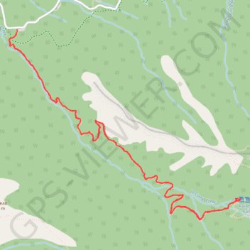
- Distance: 5.4 mi
- Elevation gain: 1,916 ft
- Maximum elevation: 4,314 ft
- Elevation loss: 1,942 ft
- Minimum elevation: 2,602 ft
- Moving time: 2 h 12 m
- Moving speed: 2.4 mph
- Maximum speed: 5.8 mph
- Total time: 2 h 44 m
- Global speed: 2.0 mph
Interactive trail map
Trail profile
- Distance: 5.4 mi
- Elevation gain: 1,916 ft
- Maximum elevation: 4,314 ft
- Elevation loss: 1,942 ft
- Minimum elevation: 2,602 ft
- Moving time: 2 h 12 m
- Moving speed: 2.4 mph
- Maximum speed: 5.8 mph
- Total time: 2 h 44 m
- Global speed: 2.0 mph
About this trail
Name: Rainbow Falls Trail in Great Smoky Mountains National Park trail, distance, elevation, map, profile, GPS track
End: Cherokee Orchard Road, Sevier County, East Tennessee, Tennessee, United States (35.67576 -83.48588)
Coordinates: 35.66070 -83.48658 35.67576 -83.46411
Topography: Sevier County topographic map, elevation, terrain
Other hiking, mountain biking, running and outdoor activity trails
Click on a trail to view its statistics, map and profile.
Great Smoky Mountains Appalachian Trail
United States > North Carolina > Clay County
Hike through Great Smoky Mountains along Appalachian Trail via Standing Indian, Ridgepole Mountain, Yellow Bald, Wine Spring Bald, Copper Ridge Bald, Cheoah Bald, Wauchecha Bald, Fontana Dam, Thunderhead Mountain, Clingmans Dome, Mount Kephart and Mount Guyot. #Hiking #Mountain #Nature #Forest #Lake…
Distance: 144.0 mi • Elevation gain: 29,111 ft • Maximum elevation: 6,604 ft