Cherry Creek Falls Trail in Marckworth State Forest
The Cherry Creek Falls Trail in Marckworth State Forest offers hikers a serene journey through lush forests, crossing gentle streams and meandering along well-maintained paths. The trail culminates at the picturesque Cherry Creek Falls, where water cascades gracefully over a rock ledge into a pool below. Along the way, hikers can enjoy the peaceful ambiance of the forest, with opportunities to observe local wildlife and the rich greenery of the Pacific Northwest. #Hiking #Waterfall #Forest #Nature
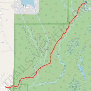
- Distance: 4.9 mi
- Elevation gain: 492 ft
- Maximum elevation: 436 ft
- Elevation loss: 489 ft
- Minimum elevation: 305 ft
- Moving time: 1 h 56 m
- Moving speed: 2.5 mph
- Maximum speed: 5.2 mph
- Total time: 2 h 4 m
- Global speed: 2.4 mph
Interactive trail map
Trail profile
- Distance: 4.9 mi
- Elevation gain: 492 ft
- Maximum elevation: 436 ft
- Elevation loss: 489 ft
- Minimum elevation: 305 ft
- Moving time: 1 h 56 m
- Moving speed: 2.5 mph
- Maximum speed: 5.2 mph
- Total time: 2 h 4 m
- Global speed: 2.4 mph
About this trail
Name: Cherry Creek Falls Trail in Marckworth State Forest trail, distance, elevation, map, profile, GPS track
End: Mountain View Road Northeast, King County, Washington, United States (47.74586 -121.90828)
Coordinates: 47.74561 -121.90831 47.76761 -121.87722
Topography: King County topographic map, elevation, terrain
Other hiking, mountain biking, running and outdoor activity trails
Click on a trail to view its statistics, map and profile.
Northern part of the Pacific Crest Trail (PCT)
United States > Oregon > Klamath County
Hike on the Pacific Crest National Scenic Trail from Crater Lake to Canada Border through Oregon and Washington along the Sierra Nevada and Cascade mountain ranges. #Hiking #Mountain #SierraNevada #Cascade #Nature #Forest #Park #PCT
Distance: 744.6 mi • Elevation gain: 145,367 ft • Maximum elevation: 7,569 ft
Cherry Creek Falls Trail in Marckworth State Forest
United States > Washington > King County
Distance: 5.4 mi • Elevation gain: 509 ft • Maximum elevation: 433 ft