Boy Scout Trail
- Distance: 8.3 mi
- Elevation gain: 1,463 ft
- Maximum elevation: 4,193 ft
- Elevation loss: 279 ft
- Minimum elevation: 2,854 ft
- Moving time: 2 h 59 m
- Moving speed: 2.8 mph
- Maximum speed: 5.4 mph
- Total time: 3 h 44 m
- Global speed: 2.2 mph
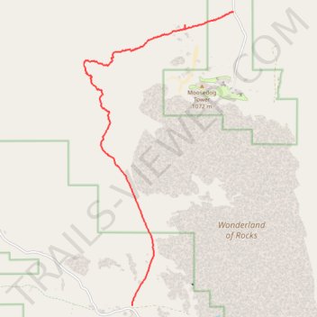
Interactive trail map
Trail profile
- Distance: 8.3 mi
- Elevation gain: 1,463 ft
- Maximum elevation: 4,193 ft
- Elevation loss: 279 ft
- Minimum elevation: 2,854 ft
- Moving time: 2 h 59 m
- Moving speed: 2.8 mph
- Maximum speed: 5.4 mph
- Total time: 3 h 44 m
- Global speed: 2.2 mph
About this trail
Name: Boy Scout Trail trail, distance, elevation, map, profile, GPS track
Start: Indian Cove, Boy Scout Trail, San Bernardino County, California, United States (34.11322 -116.15559)
Coordinates: 34.04112 -116.19994 34.11322 -116.15559
Topography: San Bernardino County topographic map, elevation, terrain
Other hiking, mountain biking, running and outdoor activity trails
Click on a trail to view its statistics, map and profile.