Make a donation
Gear up for your next adventure:
As an Amazon Associate, this site earns from qualifying purchases at no extra cost to you.
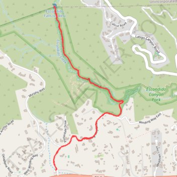
Escondido Falls via Canyon Trail
Interactive trail map
Make a donation
Gear up for your next adventure:
As an Amazon Associate, this site earns from qualifying purchases at no extra cost to you.
Trail profile
- Distance: 3.5 mi
- Elevation gain: 554 ft
- Maximum elevation: 430 ft
- Elevation loss: 554 ft
- Minimum elevation: 141 ft
- Moving time: 1 h 14 m
- Moving speed: 2.8 mph
- Maximum speed: 4.1 mph
- Total time: 1 h 23 m
- Global speed: 2.5 mph
Make a donation
Gear up for your next adventure:
As an Amazon Associate, this site earns from qualifying purchases at no extra cost to you.
About this trail
Name: Escondido Falls via Canyon Trail trail, distance, elevation, map, profile, GPS track
Coordinates: 34.02648 -118.78025 34.04228 -118.77215
Topography: Los Angeles County topographic map, elevation, terrain
Make a donation
Gear up for your next adventure:
As an Amazon Associate, this site earns from qualifying purchases at no extra cost to you.
Other hiking, mountain biking, running and outdoor activity trails
Click on a trail to view its statistics, map and profile.
Escondido Falls Trail in Escondido Canyon Park
United States > California > Los Angeles County > Malibu
The Escondido Falls Trail in Malibu offers hikers a journey through diverse landscapes, beginning with a paved path flanked by impressive hillside residences and ocean vistas. As the trail progresses into Escondido Canyon Park, adventurers are enveloped by a canopy of oak and sycamore trees, with the soothing…
Distance: 3.6 mi • Elevation gain: 538 ft • Maximum elevation: 420 ft