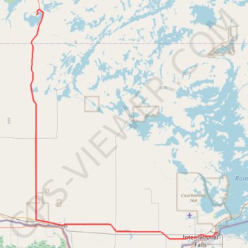
Nestor Falls - Fort Frances
#Bike
- Distance: 58.5 mi
- Elevation gain: 1,414 ft
- Maximum elevation: 1,296 ft
- Elevation loss: 1,457 ft
- Minimum elevation: 1,076 ft
Interactive trail map
Trail profile
- Distance: 58.5 mi
- Elevation gain: 1,414 ft
- Maximum elevation: 1,296 ft
- Elevation loss: 1,457 ft
- Minimum elevation: 1,076 ft
About this trail
Name: Nestor Falls - Fort Frances trail, distance, elevation, map, profile, GPS track
Coordinates: 48.60469 -93.93177 49.06901 -93.35882
Other hiking, mountain biking, running and outdoor activity trails
Click on a trail to view its statistics, map and profile.
Fort Frances - Atikokan
Canada > Ontario > Rainy River District > Fort Frances
Distance: 91.4 mi • Elevation gain: 2,972 ft • Maximum elevation: 1,450 ft