Import a GPX file

Orange County trails

Click on a trail to view its statistics, map and profile.

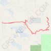
Charles H. Bronson State Forest

United States > Florida > Orange County

Hike in Charles H. Bronson State Forest from Joshua Creek Trailhead via Florida Trail and River Trail. #Hiking #Nature #Forest

Distance: 8.1 mi • Elevation gain: 69 ft • Maximum elevation: 49 ft

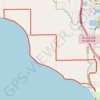
Lake Apopka

United States > Florida > Orange County

#Bike #Loop

Distance: 12.6 mi • Elevation gain: 135 ft • Maximum elevation: 131 ft

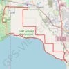
Lake Apopka

United States > Florida > Orange County

#Bike #Loop

Distance: 28.0 mi • Elevation gain: 190 ft • Maximum elevation: 112 ft

Gear up for your next adventure:

🥩Freeze-Dried Meals - Nutritious and lightweight food for remote expeditions
📡Handheld GPS Device - Reliable handheld GPS for outdoor navigation
🪶Wildlife Field Guides - Learn animal tracking and species ID
🧤Hiking Gloves - Protective gloves for rugged trails
🌎3D Topographic Globes - Raised relief globes for a tactile understanding of geography

As an Amazon Associate, this site earns from qualifying purchases at no extra cost to you.