Import a GPX file

Burnt Mills Manor trails

Click on a trail to view its statistics, map and profile.
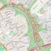
Burnt Mills East

United States > Maryland > Montgomery County > Burnt Mills > Burnt Mills Manor

Copperhead Run Trail, Devere Loop Trail and Northwest Branch Trail.

Distance: 4.3 mi • Elevation gain: 577 ft • Maximum elevation: 292 ft

Gear up for your next adventure:

🗻Climbing Gear Basics - Essential gear for beginner climbers
🛰️Handheld GPS Units - Professional satellite navigators for precise backcountry mapping
📡GPS Antenna Upgrade - Enhance GPS reception in remote terrain
🧭Map Reading Tools - Tools and kits for map navigation
🛠️Outdoor Gear Repair Kit - Essential tools to fix gear on the trail

As an Amazon Associate, this site earns from qualifying purchases at no extra cost to you.