Import a GPX file

Burnt Mills trails

Click on a trail to view its statistics, map and profile.
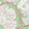
Burnt Mills East

United States > Maryland > Montgomery County > Burnt Mills > Burnt Mills Manor

Copperhead Run Trail, Devere Loop Trail and Northwest Branch Trail.

Distance: 4.3 mi • Elevation gain: 577 ft • Maximum elevation: 292 ft

Other places

Gear up for your next adventure:

💧Water Filtration Bottles - Safely drink from streams and lakes while exploring
🗺️Topographic Maps - Detailed topo maps for hiking, exploring and outdoor navigation
🧥Waterproof Jacket for Hiking - Breathable and rugged rain jacket for outdoor excursions
🛡️Insect Repellent - Protection against bugs during outdoor activities
🔭Stargazing Telescopes - Perfect for camping in low-light pollution areas shown on maps

As an Amazon Associate, this site earns from qualifying purchases at no extra cost to you.