
Wayne County trails
Click on a trail to view its statistics, map and profile.

Cliffs of the Neuse State Park Loop via Lake Trail, Spanish Moss Trail and Long Leaf Trail
United States > North Carolina > Wayne County
Distance: 3.5 mi • Elevation gain: 200 ft • Maximum elevation: 161 ft
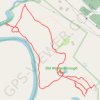
Old Waynesborough Park Yellow and Orange Loop Trail
United States > North Carolina > Wayne County > Goldsboro
Distance: 2.1 mi • Elevation gain: 33 ft • Maximum elevation: 75 ft
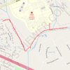
Reedy Branch Greenway
United States > North Carolina > Wayne County > Goldsboro > Forest Hill
Distance: 1.6 mi • Elevation gain: 79 ft • Maximum elevation: 118 ft
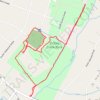
Stoney Creek Park Loop
United States > North Carolina > Wayne County > Goldsboro > Hillcrest Farm
Distance: 2.0 mi • Elevation gain: 62 ft • Maximum elevation: 108 ft

Old Waynesborough Park loop
United States > North Carolina > Wayne County > Goldsboro
Distance: 3.0 mi • Elevation gain: 49 ft • Maximum elevation: 75 ft

Old Waynesborough Park Loop
United States > North Carolina > Wayne County > Goldsboro
Distance: 1.7 mi • Elevation gain: 36 ft • Maximum elevation: 75 ft

Old Waynesborough Park Red Trail
United States > North Carolina > Wayne County > Goldsboro
Distance: 1.3 mi • Elevation gain: 26 ft • Maximum elevation: 75 ft

Cliffs of the Neuse River
United States > North Carolina > Wayne County
Distance: 1.0 mi • Elevation gain: 98 ft • Maximum elevation: 154 ft