
Orange County trails
Click on a trail to view its statistics, map and profile.
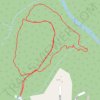
Trails in Panther Branch Natural Area
United States > North Carolina > Orange County > Jordan Oak
Distance: 1.5 mi • Elevation gain: 62 ft • Maximum elevation: 620 ft

Morgan Creek Park
United States > North Carolina > Orange County > Chapel Hill > High Park
Distance: 2.0 mi • Elevation gain: 194 ft • Maximum elevation: 430 ft
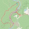
Eno River
United States > North Carolina > Orange County
Distance: 3.5 mi • Elevation gain: 223 ft • Maximum elevation: 518 ft