Import a GPX file

City of Poughkeepsie trails

Click on a trail to view its statistics, map and profile.

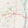
Awosting Falls Loop from Poughkeepsie

United States > New York > Dutchess County > City of Poughkeepsie

#Bike #Loop #Waterfall #Road #Forest #City #Countryside #Forest #Nature

Distance: 49.6 mi • Elevation gain: 3,622 ft • Maximum elevation: 1,348 ft

Gear up for your next adventure:

📡Handheld GPS Device - Reliable handheld GPS for outdoor navigation
🪶Fire Starter Kit - Reliable fire starter for survival and camping
🎒Waterproof Dry Bags - Keep your electronics and maps dry inside your pack
🪶Compact Camp Shovel - Folding shovel for campsite tasks
🌐World Map Poster - Decorative world maps with topographic info

As an Amazon Associate, this site earns from qualifying purchases at no extra cost to you.