
Berks County trails
Click on a trail to view its statistics, map and profile.
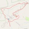
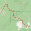
Mount Greylock
United States > Massachusetts > Berkshire County > Adams
From the Greylock Glen trailhead, the hike first follows the Glen Meadow Loop through open meadow, wetland edges and woodland, with Mount Greylock rising ahead as the route leaves the gentler Glen paths for the Bellows Pipe approach. The climb then moves into denser forest on Bellows Pipe and toward the…
Distance: 5.6 mi • Elevation gain: 2,392 ft • Maximum elevation: 3,484 ft
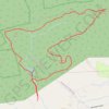
Pulpit Rock, The Pinnacle and Hamburg Reservoir Loop via Appalachian Trail
United States > Pennsylvania > Berks County > Windsor Township > Edenburg
The Pulpit Rock, Pinnacle, and Hamburg Reservoir Loop offers a rewarding hiking experience characterized by stunning vistas and diverse terrain. Along the trail, hikers can enjoy expansive views of the Lehigh Valley, rocky outcrops, and the serene beauty of the Hamburg Reservoir, making it a picturesque…
Distance: 9.3 mi • Elevation gain: 1,293 ft • Maximum elevation: 1,608 ft
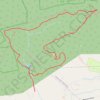
Pulpit Rock, The Pinnacle and Hamburg Reservoir Loop
United States > Pennsylvania > Berks County > Windsor Township > Edenburg
This loop trail offers a memorable hike through Pennsylvania's scenic landscape. The trail provides sweeping views from the dramatic outcrops of Pulpit Rock and The Pinnacle, where hikers can enjoy vistas of the Lehigh Valley and nearby rolling hills. Along the way, the trail winds through varied terrain, from…
Distance: 9.2 mi • Elevation gain: 1,335 ft • Maximum elevation: 1,611 ft
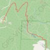
Mount Greylock via Bellows Pipe Trail in Mount Greylock State Reservation
United States > Massachusetts > Berkshire County > Adams
The Bellows Pipe Trail on Mount Greylock provides a scenic ascent through dense forests, culminating in stunning summit views. Hikers pass through lush hardwood groves, a segment of the Appalachian Trail, and reach the iconic Veterans War Memorial Tower, which offers expansive vistas of the surrounding…
Distance: 5.7 mi • Elevation gain: 2,241 ft • Maximum elevation: 3,484 ft
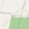
Trail from parking lot to Bash Bills Falls
United States > New York > Columbia County > Copake Falls > Mount Washington
Distance: 0.9 mi • Elevation gain: 243 ft • Maximum elevation: 1,017 ft
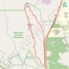
Devil's Pulpit Overlook Loop via Hickey Trail, Peeskawso Peak Trail and Mohican Monument Trail in Monument Mountain Reservation
United States > Massachusetts > Berkshire County > Great Barrington
The Devil's Pulpit Overlook Loop on Monument Mountain offers a moderately challenging hike rich in both natural beauty and historical significance. Combining the Hickey Trail, Peeskawso Peak Trail, and Mohican Monument Trail, the loop winds through dense forest, revealing ancient quartzite rock formations and…
Distance: 2.5 mi • Elevation gain: 673 ft • Maximum elevation: 1,522 ft