
Lewis County, New York, United States trails
Click on a trail to view its statistics, map and profile.
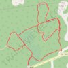
Marx Preserve loop
United States > New York > Westchester County > Town of Lewisboro
Distance: 2.3 mi • Elevation gain: 374 ft • Maximum elevation: 610 ft
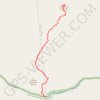
USA NY Adirondacks Jay Range Saddleback unmaintained path
United States > New York > Essex County > Town of Jay
NY Saddleback in Jay
Distance: 3.6 mi • Elevation gain: 1,329 ft • Maximum elevation: 3,573 ft

Loop including new Covered Bridge (CB) trail
United States > New York > Westchester County > Town of Lewisboro
Morning hike
Distance: 3.5 mi • Elevation gain: 367 ft • Maximum elevation: 617 ft

Leon Levy Preserve Trails
United States > New York > Westchester County > Town of Lewisboro
Distance: 2.3 mi • Elevation gain: 246 ft • Maximum elevation: 761 ft

Art Park trails and random wandering
United States > New York > Niagara County > Village of Lewiston
Distance: 5.5 mi • Elevation gain: 650 ft • Maximum elevation: 472 ft

Old Field Preserve Trails
United States > New York > Westchester County > Town of Lewisboro
Distance: 3.9 mi • Elevation gain: 440 ft • Maximum elevation: 686 ft

Grossman Preserve trails
United States > New York > Westchester County > Town of Lewisboro
Distance: 1.6 mi • Elevation gain: 246 ft • Maximum elevation: 482 ft

Onatru Preserve Loop Trail
United States > New York > Westchester County > Town of Lewisboro
Distance: 0.8 mi • Elevation gain: 30 ft • Maximum elevation: 715 ft