
Navajo County, Arizona, United States trails
Click on a trail to view its statistics, map and profile.
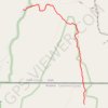
The Wave
United States > Utah > Kane County
From Wire Pass Trailhead, the route leaves House Rock Valley Road and follows the open desert toward Wire Pass, crossing sandy washes and sparse high-desert flats before entering the remote backcountry of Coyote Buttes North, a permit-only section of the Paria Canyon–Vermilion Cliffs Wilderness known for its…
Distance: 2.8 mi • Elevation gain: 699 ft • Maximum elevation: 5,233 ft
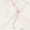
Havasu Creek Falls (Fiftyfoot Falls, Navajo Falls, Havasu Falls, Mooney Falls and Beaver Falls)
United States > Arizona > Coconino County
From Hualapai Hilltop, the route drops through dry switchbacks and open desert canyon toward Supai, a remote Havasupai village set within Havasu Canyon and not accessible by road. Beyond Supai, the trail follows the blue-green waters of Havasu Creek, passing Fiftyfoot Falls and Navajo Falls before reaching the…
Distance: 14.5 mi • Elevation gain: 5,289 ft • Maximum elevation: 5,184 ft
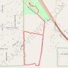
Hiking trails in Tall Timbers
United States > Arizona > Navajo County
Distance: 2.2 mi • Elevation gain: 118 ft • Maximum elevation: 6,719 ft