Import a GPX file

Vercors trails

Click on a trail to view its statistics, map and profile.
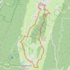
B12 A la découverte des deux villages, départ Autr

France > Auvergne-Rhône-Alpes > Isère > Autrans-Méaudre en Vercors > Autrans > Le Cornet

Distance: 10.1 mi • Elevation gain: 1,129 ft • Maximum elevation: 3,914 ft

Gear up for your next adventure:

📶Vehicle Signal Boosters - Improve reception in rural areas while driving to trailheads
📦Gear Storage Bags - Organize and protect outdoor equipment
🦺Reflective Outdoor Gear - Safety gear for low‑light conditions
🎒Gear Packing Cubes - Organize your backpack efficiently
🪶Fire Starter Kit - Reliable fire starter for survival and camping

As an Amazon Associate, this site earns from qualifying purchases at no extra cost to you.