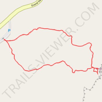
Mesa Arch Loop
Interactive trail map
Trail profile
- Distance: 0.7 mi
- Elevation gain: 105 ft
- Maximum elevation: 6,191 ft
- Elevation loss: 105 ft
- Minimum elevation: 6,099 ft
- Moving time: 23 m 21 s
- Moving speed: 1.8 mph
- Maximum speed: 2.7 mph
- Total time: 33 m 57 s
- Global speed: 1.3 mph
About this trail
Name: Mesa Arch Loop trail, distance, elevation, map, profile, GPS track
Start: Mesa Arch, Mesa Arch Loop, San Juan County, Utah, United States (38.38914 -109.86807)
Coordinates: 38.38783 -109.86810 38.38957 -109.86359
Topography: San Juan County topographic map, elevation, terrain
Other hiking, mountain biking, running and outdoor activity trails
Click on a trail to view its statistics, map and profile.
Mesa Arch Loop Trail in Canyonlands National Park
United States > Utah > San Juan County
The Mesa Arch Trail in Canyonlands National Park offers hikers a brief and accessible loop leading to the stunning Mesa Arch, a natural stone arch perched at the edge of a cliff. This formation frames expansive views of the rugged canyons below and the distant La Sal Mountains. The trail's minimal elevation…
Distance: 0.7 mi • Elevation gain: 92 ft • Maximum elevation: 6,188 ft