Make a donation
Gear up for your next adventure:
As an Amazon Associate, this site earns from qualifying purchases at no extra cost to you.
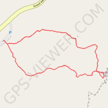
Mesa Arch Loop
Interactive trail map
Make a donation
Gear up for your next adventure:
As an Amazon Associate, this site earns from qualifying purchases at no extra cost to you.
Trail profile
- Distance: 0.7 mi
- Elevation gain: 102 ft
- Maximum elevation: 6,188 ft
- Elevation loss: 102 ft
- Minimum elevation: 6,099 ft
Make a donation
Gear up for your next adventure:
As an Amazon Associate, this site earns from qualifying purchases at no extra cost to you.
About this trail
Name: Mesa Arch Loop trail, distance, elevation, map, profile, GPS track
Coordinates: 38.38783 -109.86812 38.38958 -109.86358
Topography: San Juan County topographic map, elevation, terrain
Make a donation
Gear up for your next adventure:
As an Amazon Associate, this site earns from qualifying purchases at no extra cost to you.
Other hiking, mountain biking, running and outdoor activity trails
Click on a trail to view its statistics, map and profile.
Mesa Arch Loop Trail in Canyonlands National Park
United States > Utah > San Juan County
The Mesa Arch Trail in Canyonlands National Park offers hikers a brief and accessible loop leading to the stunning Mesa Arch, a natural stone arch perched at the edge of a cliff. This formation frames expansive views of the rugged canyons below and the distant La Sal Mountains. The trail's minimal elevation…
Distance: 0.7 mi • Elevation gain: 92 ft • Maximum elevation: 6,188 ft