Hike from Glenfinnan to A Chùil
- Distance: 12.6 mi
- Elevation gain: 2,451 ft
- Maximum elevation: 1,634 ft
- Elevation loss: 2,313 ft
- Minimum elevation: 46 ft
- Moving time: 5 h 54 m
- Moving speed: 2.1 mph
- Maximum speed: 3.8 mph
- Total time: 7 h 38 m
- Global speed: 1.7 mph
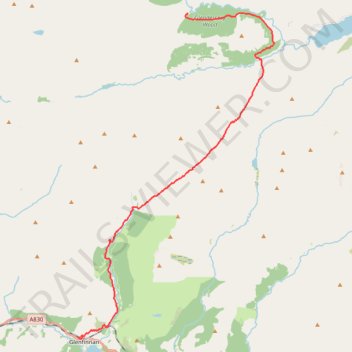
Interactive trail map
Trail profile
- Distance: 12.6 mi
- Elevation gain: 2,451 ft
- Maximum elevation: 1,634 ft
- Elevation loss: 2,313 ft
- Minimum elevation: 46 ft
- Moving time: 5 h 54 m
- Moving speed: 2.1 mph
- Maximum speed: 3.8 mph
- Total time: 7 h 38 m
- Global speed: 1.7 mph
About this trail
Name: Hike from Glenfinnan to A Chùil trail, distance, elevation, map, profile, GPS track
Start: Glenfinnan, Highland, Scotland, PH37 4LT, United Kingdom (56.87242 -5.44988)
End: A' Chùil, Highland, Scotland, United Kingdom (56.97700 -5.38455)
Coordinates: 56.87186 -5.44988 56.97728 -5.33351
Other hiking, mountain biking, running and outdoor activity trails
Click on a trail to view its statistics, map and profile.
Hike from A Chùil to Sourlies
United Kingdom > Scotland > Highland
Distance: 8.0 mi • Elevation gain: 1,237 ft • Maximum elevation: 1,037 ft
Munro Hillwalk Sgurr Coireachan Sgurr Thuilm
United Kingdom > Scotland > Highland > Glenfinnan
Munro, Hillwalk, Sgurr, Coireachan, Sgurr, Thuilm
Distance: 16.4 mi • Elevation gain: 4,767 ft • Maximum elevation: 3,143 ft
Munro Hillwalk Gulvain
United Kingdom > Scotland > Highland > Drumsallie
Munro, hillwalk, Gulvain
Distance: 14.9 mi • Elevation gain: 4,062 ft • Maximum elevation: 3,196 ft