Make a donation
Gear up for your next adventure:
As an Amazon Associate, this site earns from qualifying purchases at no extra cost to you.
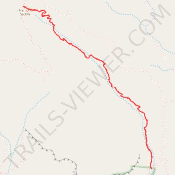
Fremont Saddle via Peralta Canyon Trail in Superstition Wilderness
The Peralta Trail to Fremont Saddle offers a rewarding hike through Arizona's Superstition Mountains, culminating in a panoramic view of the iconic Weavers Needle. As you ascend, the trail winds through diverse desert flora, including oak and mesquite trees, with rugged volcanic rock formations towering above. Upon reaching Fremont Saddle, you're greeted with expansive vistas of Boulder Canyon and a labyrinth of washes, mesas, and peaks, showcasing the area's rich geological history. #Hiking #Mountain #Forest #Rock #Overlook #Nature
- Distance: 4.5 mi
- Elevation gain: 1,355 ft
- Maximum elevation: 3,773 ft
- Elevation loss: 1,355 ft
- Minimum elevation: 2,415 ft
- Moving time: 3 h 14 m
- Moving speed: 1.4 mph
- Maximum speed: 2.9 mph
- Total time: 4 h 3 m
- Global speed: 1.1 mph
Interactive trail map
Make a donation
Gear up for your next adventure:
As an Amazon Associate, this site earns from qualifying purchases at no extra cost to you.
Trail profile
- Distance: 4.5 mi
- Elevation gain: 1,355 ft
- Maximum elevation: 3,773 ft
- Elevation loss: 1,355 ft
- Minimum elevation: 2,415 ft
- Moving time: 3 h 14 m
- Moving speed: 1.4 mph
- Maximum speed: 2.9 mph
- Total time: 4 h 3 m
- Global speed: 1.1 mph
Make a donation
Gear up for your next adventure:
As an Amazon Associate, this site earns from qualifying purchases at no extra cost to you.
About this trail
Name: Fremont Saddle via Peralta Canyon Trail in Superstition Wilderness trail, distance, elevation, map, profile, GPS track
Start: Peralta Canyon Trail, Pinal County, Arizona, United States (33.39763 -111.34789)
End: Peralta Canyon Trail, Pinal County, Arizona, United States (33.39763 -111.34788)
Coordinates: 33.39763 -111.36513 33.41583 -111.34779
Topography: Pinal County topographic map, elevation, terrain
Make a donation
Gear up for your next adventure:
As an Amazon Associate, this site earns from qualifying purchases at no extra cost to you.
Other hiking, mountain biking, running and outdoor activity trails
Click on a trail to view its statistics, map and profile.
Fremont Saddle and Weaver's Needle Loop via Peralta Canyon Trail and Cave Trail
United States > Arizona > Pinal County
This loop offers an excellent combination of rugged desert beauty and rewarding vistas. As you ascend the Peralta Canyon Trail, the trail weaves through a vibrant Sonoran Desert landscape, featuring towering saguaro cacti and jagged rock pinnacles. Once reaching Fremont Saddle, hikers are treated to a…
Distance: 5.4 mi • Elevation gain: 1,637 ft • Maximum elevation: 3,812 ft
Wave Cave Trail in Superstition Wilderness
United States > Arizona > Pinal County
The Wave Cave Trail in Arizona's Superstition Mountains offers hikers a journey through a landscape adorned with towering saguaro cacti, prickly pear, and mesquite trees. The trail leads to a captivating cave featuring a distinctive rock formation resembling a wave, providing a unique photo opportunity. From…
Distance: 3.1 mi • Elevation gain: 958 ft • Maximum elevation: 3,166 ft
Make a donation
Gear up for your next adventure:
As an Amazon Associate, this site earns from qualifying purchases at no extra cost to you.