Fremont Saddle and Weaver's Needle Loop via Peralta Canyon Trail and Cave Trail
This loop offers an excellent combination of rugged desert beauty and rewarding vistas. As you ascend the Peralta Canyon Trail, the trail weaves through a vibrant Sonoran Desert landscape, featuring towering saguaro cacti and jagged rock pinnacles. Once reaching Fremont Saddle, hikers are treated to a breathtaking view of the iconic Weaver's Needle, a striking rock formation that rises sharply above the desert floor. Continuing beyond the saddle, the landscape becomes even more expansive, offering an immersive wilderness experience with panoramic views of the Superstition Mountains. #Hiking #Loop #Canyon #Desert #Nature
- Distance: 5.4 mi
- Elevation gain: 1,637 ft
- Maximum elevation: 3,812 ft
- Elevation loss: 1,621 ft
- Minimum elevation: 2,415 ft
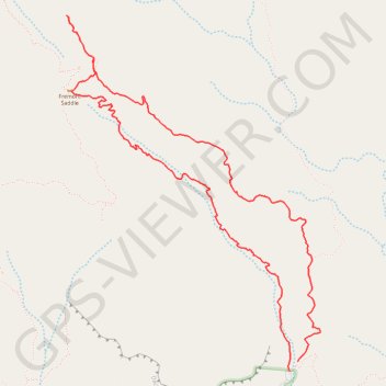
Interactive trail map
Trail profile
- Distance: 5.4 mi
- Elevation gain: 1,637 ft
- Maximum elevation: 3,812 ft
- Elevation loss: 1,621 ft
- Minimum elevation: 2,415 ft
About this trail
Name: Fremont Saddle and Weaver's Needle Loop via Peralta Canyon Trail and Cave Trail trail, distance, elevation, map, profile, GPS track
Start: Peralta Canyon Trail, Pinal County, Arizona, United States (33.39765 -111.34786)
End: Bluff Spring Trail, Pinal County, Arizona, United States (33.39833 -111.34720)
Coordinates: 33.39765 -111.36511 33.42066 -111.34551
Topography: Pinal County topographic map, elevation, terrain
Other hiking, mountain biking, running and outdoor activity trails
Click on a trail to view its statistics, map and profile.
Fremont Saddle via Peralta Canyon Trail in Superstition Wilderness
United States > Arizona > Pinal County
The Peralta Trail to Fremont Saddle offers a rewarding hike through Arizona's Superstition Mountains, culminating in a panoramic view of the iconic Weavers Needle. As you ascend, the trail winds through diverse desert flora, including oak and mesquite trees, with rugged volcanic rock formations towering above.…
Distance: 4.5 mi • Elevation gain: 1,355 ft • Maximum elevation: 3,773 ft
Wave Cave Trail in Superstition Wilderness
United States > Arizona > Pinal County
The Wave Cave Trail in Arizona's Superstition Mountains offers hikers a journey through a landscape adorned with towering saguaro cacti, prickly pear, and mesquite trees. The trail leads to a captivating cave featuring a distinctive rock formation resembling a wave, providing a unique photo opportunity. From…
Distance: 3.1 mi • Elevation gain: 958 ft • Maximum elevation: 3,166 ft