Make a donation
Gear up for your next adventure:
As an Amazon Associate, this site earns from qualifying purchases at no extra cost to you.
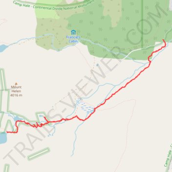
Mayflower Lake, Continental Falls and Mohawk Lakes
Interactive trail map
Make a donation
Gear up for your next adventure:
As an Amazon Associate, this site earns from qualifying purchases at no extra cost to you.
Trail profile
- Distance: 6.9 mi
- Elevation gain: 1,834 ft
- Maximum elevation: 12,093 ft
- Elevation loss: 1,834 ft
- Minimum elevation: 10,344 ft
- Moving time: 4 h 22 m
- Moving speed: 1.6 mph
- Maximum speed: 3.7 mph
- Total time: 6 h 28 m
- Global speed: 1.1 mph
Make a donation
Gear up for your next adventure:
As an Amazon Associate, this site earns from qualifying purchases at no extra cost to you.
About this trail
Name: Mayflower Lake, Continental Falls and Mohawk Lakes trail, distance, elevation, map, profile, GPS track
Coordinates: 39.41903 -106.08989 39.43707 -106.05000
Topography: Summit County topographic map, elevation, terrain
Make a donation
Gear up for your next adventure:
As an Amazon Associate, this site earns from qualifying purchases at no extra cost to you.
Other hiking, mountain biking, running and outdoor activity trails
Click on a trail to view its statistics, map and profile.
Mohawk Lakes, Continental Falls and Mayflower Lake in White River National Forest
United States > Colorado > Summit County
The Spruce Creek Trail in Colorado's White River National Forest offers hikers a journey through dense forests and serene meadows, leading to the tranquil Mayflower Lake. Further along, the trail ascends beside the cascading Continental Falls, providing glimpses into the area's rich mining history with…
Distance: 6.8 mi • Elevation gain: 1,818 ft • Maximum elevation: 12,106 ft