Black Duck
- Distance: 8.7 mi
- Elevation gain: 2,028 ft
- Maximum elevation: 1,470 ft
- Elevation loss: 2,021 ft
- Minimum elevation: 922 ft
- Moving time: 2 h 23 m
- Moving speed: 3.6 mph
- Maximum speed: 18.1 mph
- Total time: 7 h 47 m
- Global speed: 1.1 mph
Interactive trail map
Trail profile
- Distance: 8.7 mi
- Elevation gain: 2,028 ft
- Maximum elevation: 1,470 ft
- Elevation loss: 2,021 ft
- Minimum elevation: 922 ft
- Moving time: 2 h 23 m
- Moving speed: 3.6 mph
- Maximum speed: 18.1 mph
- Total time: 7 h 47 m
- Global speed: 1.1 mph
About this trail
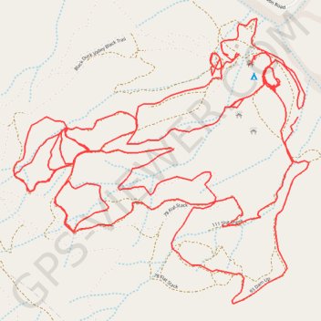
Name: Black Duck trail, distance, elevation, map, profile, GPS track
Start: Wombat Track, East Haldon, Lockyer Valley Regional, Queensland, Australia (-27.84494 152.21373)
Coordinates: -27.85174 152.20193 -27.84130 152.21417
Other hiking, mountain biking, running and outdoor activity trails
Click on a trail to view its statistics, map and profile.
Warwick - Gatton
Australia > Queensland > Warwick
#Bike
Distance: 77.8 mi • Elevation gain: 2,664 ft • Maximum elevation: 1,909 ft
Black Duck
Distance: 28.4 mi • Elevation gain: 2,057 ft • Maximum elevation: 1,867 ft