Import a GPX file

Bear Creek Oasis

Hike from Cove Oasis to Bear Creek Oasis via the Bear Creek Trail in the Santa Rosa Wilderness. #Hiking #Oasis #Nature #Desert #Mountain #Wilderness

  • Distance: 4.4 mi
  • Elevation gain: 2,129 ft
  • Maximum elevation: 2,303 ft
  • Elevation loss: 167 ft
  • Minimum elevation: 338 ft

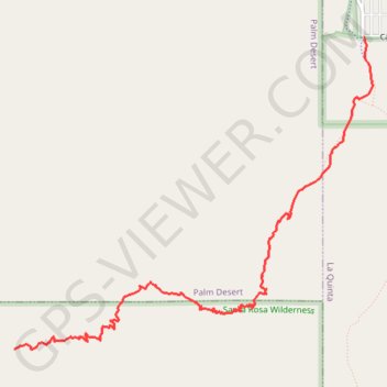
Interactive trail map

Trail profile

  • Distance: 4.4 mi
  • Elevation gain: 2,129 ft
  • Maximum elevation: 2,303 ft
  • Elevation loss: 167 ft
  • Minimum elevation: 338 ft

About this trail

Other hiking, mountain biking, running and outdoor activity trails

Click on a trail to view its statistics, map and profile.

Lake Cahuilla to Cove Oasis Loop

United States > California > Riverside County > La Quinta

Loop hike from Lake Cahuilla Park to Cove Oasis via Boo Hoff Trail in the Santa Rosa Wilderness. #Hiking #Loop #Lake #Nature #Mountain #Wilderness #Desert

Distance: 10.8 mi • Elevation gain: 2,208 ft • Maximum elevation: 1,893 ft

Boo Hoff Trail Loop

United States > California > Riverside County > La Quinta

Loop hike in the Santa Rosa Wilderness from the Cove Oasis via Boo Hoff Trail, Devil Canyon and Lake Cahuilla. #Hiking #Loop #Mountain #Wilderness #Nature #Canyon #Lake

Distance: 12.4 mi • Elevation gain: 2,336 ft • Maximum elevation: 1,893 ft

Gear up for your next adventure:

🔋Solar Power Banks - Keep your GPS and phone charged in remote wilderness areas
🌡️Handheld Weather Meters - Measure wind, temp, and pressure for safe mountain travel
🩳Quick‑Dry Hiking Shorts - Comfortable and quick‑dry shorts for summer hiking
📚Navigation Handbooks - Master the art of reading topographic maps and using a compass
🧢Sun Protection Hats - Wide-brimmed and UPF-rated hats for high-altitude sun safety

As an Amazon Associate, this site earns from qualifying purchases at no extra cost to you.