Make a donation
Gear up for your next adventure:
As an Amazon Associate, this site earns from qualifying purchases at no extra cost to you.
Eagle Lake via Upper Eagle Falls
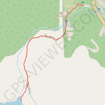
Interactive trail map
Make a donation
Gear up for your next adventure:
As an Amazon Associate, this site earns from qualifying purchases at no extra cost to you.
Trail profile
- Distance: 1.9 mi
- Elevation gain: 443 ft
- Maximum elevation: 7,018 ft
- Elevation loss: 443 ft
- Minimum elevation: 6,585 ft
Make a donation
Gear up for your next adventure:
As an Amazon Associate, this site earns from qualifying purchases at no extra cost to you.
About this trail
Name: Eagle Lake via Upper Eagle Falls trail, distance, elevation, map, profile, GPS track
Start: Eagle Lake Trail, El Dorado County, California, United States (38.95197 -120.11317)
End: Eagle Lake Trail, El Dorado County, California, United States (38.95197 -120.11317)
Coordinates: 38.94328 -120.12054 38.95207 -120.11317
Topography: El Dorado County topographic map, elevation, terrain
Make a donation
Gear up for your next adventure:
As an Amazon Associate, this site earns from qualifying purchases at no extra cost to you.
Other hiking, mountain biking, running and outdoor activity trails
Click on a trail to view its statistics, map and profile.
Eagle Lake Trail in Desolation Wilderness
United States > California > El Dorado County
The Eagle Lake Trail in California's Desolation Wilderness offers a moderately challenging hike through a picturesque landscape of towering pines, granite peaks, and cascading waterfalls. Starting near Emerald Bay, the trail ascends past the scenic Eagle Falls before reaching the serene Eagle Lake, nestled…
Distance: 1.9 mi • Elevation gain: 456 ft • Maximum elevation: 7,021 ft