Estherwood Trail
- Distance: 2.6 mi
- Elevation gain: 348 ft
- Maximum elevation: 463 ft
- Elevation loss: 348 ft
- Minimum elevation: 236 ft
- Moving time: 54 m 52 s
- Moving speed: 2.9 mph
- Maximum speed: 5.7 mph
- Total time: 1 h 15 s
- Global speed: 2.6 mph
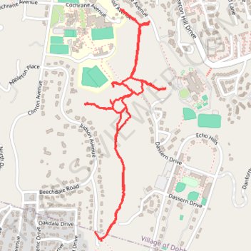
Interactive trail map
Trail profile
- Distance: 2.6 mi
- Elevation gain: 348 ft
- Maximum elevation: 463 ft
- Elevation loss: 348 ft
- Minimum elevation: 236 ft
- Moving time: 54 m 52 s
- Moving speed: 2.9 mph
- Maximum speed: 5.7 mph
- Total time: 1 h 15 s
- Global speed: 2.6 mph
About this trail
Name: Estherwood Trail trail, distance, elevation, map, profile, GPS track
Coordinates: 41.00024 -73.86956 41.01141 -73.86435
Topography: Westchester County topographic map, elevation, terrain
Other hiking, mountain biking, running and outdoor activity trails
Click on a trail to view its statistics, map and profile.
Old Croton Aqueduct Trail and Bronx
United States > New York > Westchester County > Village of Croton-on-Hudson
Distance: 44.0 mi • Elevation gain: 2,700 ft • Maximum elevation: 262 ft