Import a GPX file

Fairy Creek Waterfall Trail

#Hiking #MTB #Snowshoeing #Forest #Falls

  • Distance: 2.8 mi
  • Elevation gain: 486 ft
  • Maximum elevation: 3,553 ft
  • Elevation loss: 486 ft
  • Minimum elevation: 3,307 ft

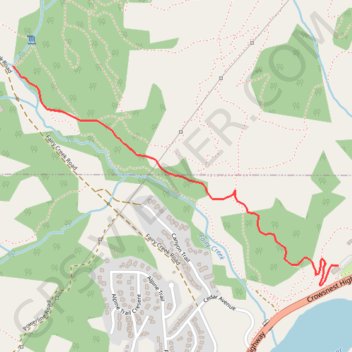
Interactive trail map

Trail profile

  • Distance: 2.8 mi
  • Elevation gain: 486 ft
  • Maximum elevation: 3,553 ft
  • Elevation loss: 486 ft
  • Minimum elevation: 3,307 ft

About this trail

Other hiking, mountain biking, running and outdoor activity trails

Click on a trail to view its statistics, map and profile.

Cranbrook - Fernie

Canada > British Columbia > Regional District of East Kootenay > Cranbrook

#Bike #Cranbrook #Fernie

Distance: 62.3 mi • Elevation gain: 2,520 ft • Maximum elevation: 3,294 ft

Fernie - Blairmore

Canada > British Columbia > Regional District of East Kootenay > Fernie

#Bike #Fernie #Blairmore

Distance: 42.4 mi • Elevation gain: 2,238 ft • Maximum elevation: 4,570 ft

Gear up for your next adventure:

🪶Compact Camp Shovel - Folding shovel for campsite tasks
🍳Camping Cook Set - Complete cookware for outdoor meals
📱Heavy-Duty Phone Cases - Drop-proof and waterproof protection for outdoor navigation
📦Dry Bags Set - Waterproof storage for electronics and clothes
🦟Ultrasonic Repellers - Create a bug-free zone at your camp or rest stop

As an Amazon Associate, this site earns from qualifying purchases at no extra cost to you.