Fernie - Blairmore
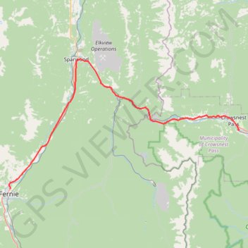
Interactive trail map
Trail profile
- Distance: 42.4 mi
- Elevation gain: 2,238 ft
- Maximum elevation: 4,570 ft
- Elevation loss: 1,240 ft
- Minimum elevation: 3,281 ft
About this trail
Name: Fernie - Blairmore trail, distance, elevation, map, profile, GPS track
Coordinates: 49.51294 -115.06157 49.73331 -114.45937
Other hiking, mountain biking, running and outdoor activity trails
Click on a trail to view its statistics, map and profile.
Blairmore - Pincher Creek
Canada > Alberta > Crowsnest Pass
#Bike #Blairmore #PincherCreek
Distance: 29.4 mi • Elevation gain: 850 ft • Maximum elevation: 4,278 ft
Fairy Creek Waterfall Trail
Canada > British Columbia > Regional District of East Kootenay > Fernie
#Hiking #MTB #Snowshoeing #Forest #Falls
Distance: 2.8 mi • Elevation gain: 486 ft • Maximum elevation: 3,553 ft