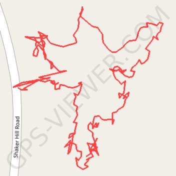
Suky Marsh Trail
Afternoon Hike
- Distance: 1.5 mi
- Elevation gain: 174 ft
- Maximum elevation: 991 ft
- Elevation loss: 171 ft
- Minimum elevation: 879 ft
- Moving time: 59 m 28 s
- Moving speed: 1.5 mph
- Maximum speed: 12.3 mph
- Total time: 1 h 9 m
- Global speed: 1.3 mph
Interactive trail map
Trail profile
- Distance: 1.5 mi
- Elevation gain: 174 ft
- Maximum elevation: 991 ft
- Elevation loss: 171 ft
- Minimum elevation: 879 ft
- Moving time: 59 m 28 s
- Moving speed: 1.5 mph
- Maximum speed: 12.3 mph
- Total time: 1 h 9 m
- Global speed: 1.3 mph
About this trail
Name: Suky Marsh Trail trail, distance, elevation, map, profile, GPS track
Start: Suky Marsh trail, Enfield, Grafton County, New Hampshire, 03748, United States (43.61141 -72.11310)
End: Suky Marsh trail, Enfield, Grafton County, New Hampshire, 03748, United States (43.61131 -72.11341)
Coordinates: 43.61003 -72.11352 43.61259 -72.11027
Topography: Grafton County topographic map, elevation, terrain
Other hiking, mountain biking, running and outdoor activity trails
Click on a trail to view its statistics, map and profile.
Crystal Lake Trail
United States > New Hampshire > Grafton County > Enfield
Distance: 13.9 mi • Elevation gain: 1,171 ft • Maximum elevation: 1,132 ft