
Curry Village trails
Click on a trail to view its statistics, map and profile.
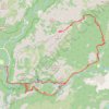
Half Dome
United States > California > Mariposa County > Curry Village
From Happy Isles, this demanding Yosemite route follows the Merced River into the forested canyon of the Mist Trail, passing the spray and granite stairways of Vernal Fall before continuing above the river toward Emerald Pool and the broader waterfall amphitheater around Nevada Fall. Beyond Nevada Fall, the…
Distance: 15.4 mi • Elevation gain: 6,506 ft • Maximum elevation: 8,816 ft
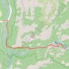
Vernal Falls
United States > California > Mariposa County > Curry Village
From Happy Isles, the route follows the John Muir Trail and Mist Trail along the Merced River, moving through forested Yosemite Valley scenery toward the narrowing granite canyon below Vernal Fall. The itinerary passes the Vernal Fall Footbridge, continues beside the river, and climbs into the Mist Trail…
Distance: 3.6 mi • Elevation gain: 1,575 ft • Maximum elevation: 5,197 ft
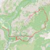
Half Dome via Vernal and Nevada Falls
United States > California > Mariposa County > Curry Village
Starting near Happy Isles in eastern Yosemite Valley, this route follows the Merced River into the Mist Trail corridor, with early granite scenery and possible views toward Illilouette Fall before reaching the Vernal Fall Footbridge. The ascent then climbs beside Vernal Fall to Emerald Pool and Silver Apron,…
Distance: 16.6 mi • Elevation gain: 6,739 ft • Maximum elevation: 8,835 ft
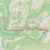
Vernal Fall and Nevada Fall
United States > California > Mariposa County > Curry Village
From Happy Isles, the hike enters the eastern end of Yosemite Valley and follows the Merced River through forest and granite scenery toward the Vernal Fall Footbridge, where the first open views of the river and surrounding canyon set the tone for one of Yosemite’s most iconic waterfall routes. The Mist…
Distance: 2.9 mi • Elevation gain: 2,228 ft • Maximum elevation: 6,007 ft
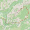
Half Dome via John Muir Trail and Vernal Fall in Yosemite National Park
United States > California > Mariposa County > Curry Village
The Half Dome hike is a true Yosemite adventure. With breathtaking views of the falls, Yosemite Valley, and the Sierra Nevada, it rewards those who tackle its challenging terrain. The final ascent up the cable route is thrilling, and while demanding, it’s an unforgettable experience that’s well worth the…
Distance: 16.3 mi • Elevation gain: 6,368 ft • Maximum elevation: 8,816 ft
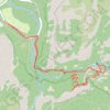
Vernal Fall and Clark Point Loop
United States > California > Mariposa County > Curry Village
The route follows the river upstream toward the waterfall approach, passing through a lively canyon setting shaped by clear pools, polished rock and constant movement from the Merced. The hike then joins the Mist Trail, where the scenery becomes more dramatic beneath Vernal Fall, with spray, stone steps, cliff…
Distance: 5.9 mi • Elevation gain: 2,644 ft • Maximum elevation: 5,574 ft

Nevada falls hike
United States > California > Mariposa County > Curry Village
Distance: 10.0 mi • Elevation gain: 4,636 ft • Maximum elevation: 6,007 ft
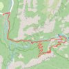
Vernal Fall and Clark Point loop via John Muir Trail and Mist Trail Trail in Yosemite National Park
United States > California > Mariposa County > Curry Village
The Vernal Fall and Clark Point loop is a strenuous yet rewarding hike through the heart of Yosemite’s beauty. The journey takes you up steep steps alongside Vernal Fall, before leading to sweeping views of the valley from Clark Point. Though challenging, the mix of waterfalls, granite cliffs, and forested…
Distance: 5.0 mi • Elevation gain: 2,395 ft • Maximum elevation: 5,587 ft
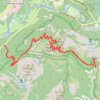
Glacier Point and Union Point via Four Mile Trail
United States > California > Mariposa County > Yosemite Village > Yosemite Lodge
From Yosemite Valley, the Four Mile Trail climbs away from the Merced River through forested slopes and long switchbacks on the south wall of the valley, steadily opening views toward Sentinel Rock, El Capitan, Yosemite Falls, and the granite cliffs that frame the valley floor. Higher on the route, the path…
Distance: 9.4 mi • Elevation gain: 5,404 ft • Maximum elevation: 7,208 ft
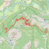
Glacier Point
United States > California > Mariposa County > Curry Village
Starting at Four Mile Trailhead in Yosemite Valley, the route joins the Four Mile Trail and begins its steady climb from the valley floor above the Merced River corridor. It first rises through forested slopes near Sentinel Creek, with early views opening toward Sentinel Rock and the meadows of Yosemite…
Distance: 4.8 mi • Elevation gain: 4,101 ft • Maximum elevation: 7,208 ft
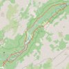
Mirror Lake and Valley Loop Trail in Yosemite National Park
United States > California > Mariposa County > Curry Village
The Mirror Lake and Valley Loop Trail in Yosemite National Park offers hikers stunning views of Tenaya Canyon, Mount Watkins, and the Washington Column, all beneath the iconic Half Dome. This relatively easy trail winds through lush forests and along the tranquil Tenaya Creek, leading to Mirror Lake, which…
Distance: 4.5 mi • Elevation gain: 443 ft • Maximum elevation: 4,190 ft
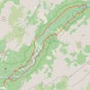
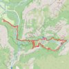
Vernal Fall, Nevada Fall and Clark Point loop via John Muir Trail and Mist Trail
United States > California > Mariposa County > Curry Village
The Vernal Fall and Nevada Fall loop hike is a fantastic adventure through Yosemite, offering some of the park's most iconic waterfall views. You'll tackle steep inclines, including the famous "Nature's Giant Staircase" with over 600 steps, but the effort is rewarded with breathtaking panoramas of cascading…
Distance: 8.1 mi • Elevation gain: 3,186 ft • Maximum elevation: 6,060 ft
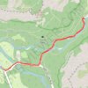
Mirror Lake Trail in Yosemite National Park
United States > California > Mariposa County > Curry Village
The Mirror Lake Trail in Yosemite National Park offers a peaceful hike through Tenaya Canyon, framed by dramatic granite cliffs like Half Dome and North Dome. The trail winds alongside Tenaya Creek, providing a serene experience with forested sections, sandy riverbeds, and seasonal reflections in the lake,…
Distance: 2.8 mi • Elevation gain: 230 ft • Maximum elevation: 4,124 ft
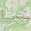
Nevada Fall via Mist Trail and Vernal Fall in Yosemite National Park
United States > California > Mariposa County > Curry Village
Hiking the Mist Trail to Nevada Fall in Yosemite National Park offers an exhilarating journey through some of the park's most iconic landscapes. As you ascend, you'll first encounter the mesmerizing Vernal Fall, with its cascading waters often creating vibrant rainbows in the mist. Continuing upward, the trail…
Distance: 6.1 mi • Elevation gain: 2,480 ft • Maximum elevation: 6,007 ft
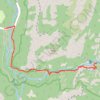
Vernal Fall and Emerald Pool via John Muir Trail and Mist Trail in Yosemite National Park
United States > California > Mariposa County > Curry Village
Hiking to Vernal Fall and Emerald Pool is an unforgettable adventure! The trail starts easy, but be ready for steep climbs and a series of misty granite steps, especially near the falls, where the refreshing spray from Vernal Fall makes the journey exhilarating. At the top, you'll be rewarded with stunning…
Distance: 3.5 mi • Elevation gain: 1,427 ft • Maximum elevation: 5,144 ft
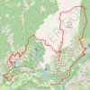
Yosemite North Dome Loop
United States > California > Mariposa County > Curry Village
Loop hike to North Dome via Lower Mirror Lake, Tenaya Creek, Valley Loop Trail, Snow Creek Trail, North Dome Trail, Upper Yosemite Fall Trail, Oh My Gosh Point and Columbia Rock in the Yosemite National Park. #Hiking #Loop #Mountain #Nature #Lake #Forest #Fall #Park #Yosemite
Distance: 19.9 mi • Elevation gain: 7,464 ft • Maximum elevation: 8,150 ft
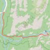
Vernal Fall via John Muir Trail and Mist Trail in Yosemite National Park
United States > California > Mariposa County > Curry Village
The Vernal Fall hike offers a visually captivating journey through Yosemite's diverse landscapes. The Mist Trail, which approaches the fall directly, presents hikers with striking close-up views of Vernal Fall as the path winds upward alongside the cascading waters. As you ascend, the dramatic spray from the…
Distance: 1.5 mi • Elevation gain: 1,217 ft • Maximum elevation: 5,128 ft
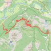
Four Mile Trail to Glacier Point and Union Point in Yosemite National Park
United States > California > Mariposa County > Yosemite Village > Yosemite Lodge
The Four Mile Trail in Yosemite National Park offers hikers a strenuous ascent from Yosemite Valley to Glacier Point, providing panoramic views of iconic landmarks. Along the route, hikers can observe the grandeur of El Capitan and Yosemite Falls, the expansive vistas of Yosemite Valley, and the impressive…
Distance: 10.0 mi • Elevation gain: 5,489 ft • Maximum elevation: 7,208 ft
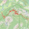
Glacier Point via Four Mile Trail in Yosemite National Park
United States > California > Mariposa County > Yosemite Village > Yosemite Lodge
Hiking the Four-Mile Trail to Glacier Point offers some of the best views in Yosemite National Park, with expansive vistas unfolding gradually as you ascend. Along the way, hikers can admire iconic landmarks like Yosemite Falls, El Capitan, and Half Dome, as well as the deep reaches of Tenaya Canyon. Though…
Distance: 4.7 mi • Elevation gain: 4,114 ft • Maximum elevation: 7,244 ft
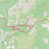
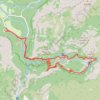
Nevada Fall Loop
United States > California > Mariposa County > Curry Village
Loop hike from Curry Village to Nevada Fall via Happy Isles Bridge, Merced River, John Muir Trail, Mist Trail, Vernal Fall and Clark Point in the Yosemite National Park. #Hiking #Loop #Mountain #River #Falls #Nature #Forest #Park #Yosemite
Distance: 8.9 mi • Elevation gain: 3,783 ft • Maximum elevation: 6,066 ft
Ledge Trail to Glacier Point
United States > California > Mariposa County > Curry Village
Mariposa County Hiking
Distance: 2.6 mi • Elevation gain: 4,734 ft • Maximum elevation: 7,208 ft
Vernal and Nevada Falls Loop
United States > California > Mariposa County > Curry Village
Distance: 7.4 mi • Elevation gain: 2,986 ft • Maximum elevation: 6,056 ft
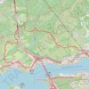
元荃古道石龍拱
China > Hong Kong > Tsuen Wan District > Tsuen Wan > Tam Teng San Tsuen
行山樂
Distance: 6.9 mi • Elevation gain: 1,680 ft • Maximum elevation: 1,325 ft