Import a GPX file

Calgary trails

Click on a trail to view its statistics, map and profile.
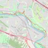
Baker Park - Bowmont Park - Dale Hodges Park

Canada > Alberta > Calgary

Bow River. #Hiking #Running #MTB #Loop

Distance: 7.9 mi • Elevation gain: 745 ft • Maximum elevation: 3,638 ft

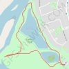
Carburn Park Pond Loop

Canada > Alberta > Calgary

Carburn Park. #Hiking #Running #Loop #Lake #Park #Forest #Nature #River

Distance: 1.4 mi • Elevation gain: 39 ft • Maximum elevation: 3,363 ft

Sightseeing Calgary

Canada > Alberta > Calgary

#Hiking #Loop #Calgary

Distance: 14.2 mi • Elevation gain: 1,119 ft • Maximum elevation: 3,632 ft

Fish Creek Provincial Park Loop Walk

Canada > Alberta > Calgary

Distance: 3.5 mi • Elevation gain: 52 ft • Maximum elevation: 3,330 ft

Gear up for your next adventure:

📌Outdoor GPS Map App - Apps and devices for digital topographic navigation
🖼️Topo Map Wall Art - Decorative topographic prints of famous peaks and regions
👟Men's Trail Runners - Lightweight footwear for fast-paced exploration and light hiking
🚪Portable Camp Chair - Foldable chair for comfort at camp
🧭Pro Hiking Compasses - High-accuracy liquid-filled compasses for topographic orientation

As an Amazon Associate, this site earns from qualifying purchases at no extra cost to you.